Drone Agriculture Mapping: How It Works and the Careers It Builds
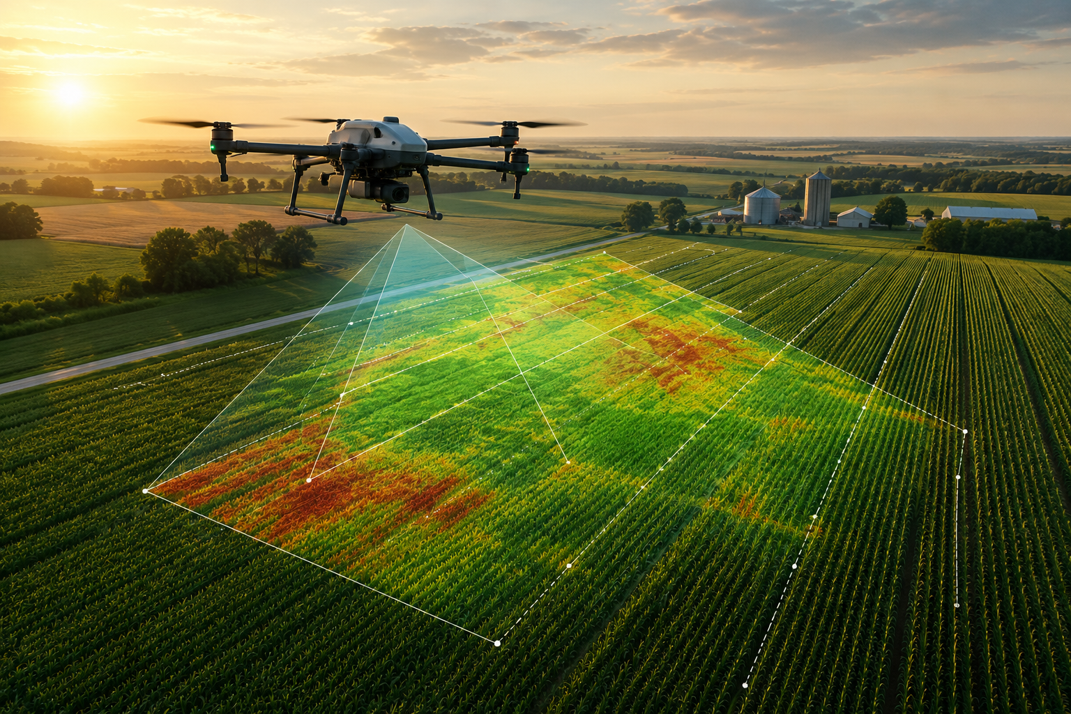
Drone agriculture mapping is the practice of flying a field to build measurable maps a farmer can act on — for a broader overview of how drones are used across agriculture, see the main guide. This article stays on mapping: how the workflow runs, what farmers actually do with the maps, the qualifications employers want, and where the careers are.
The agricultural drone market sat somewhere between $2.6 billion and $3.7 billion in 2025, with growth estimates ranging from roughly 10% to 33% CAGR across research firms like Grand View Research, MarketsandMarkets, and Barchart. The spread is wide because firms count the market differently — so read it as a range, not a single number. Crop monitoring and field mapping already make up the largest slice of that market. But here is the tension worth noticing: hardware is the biggest segment, while software and services are growing fastest. In other words, the drone is not the product. The map is. And a drone that can’t be turned into a decision is just a camera.
Key Takeaways
- The deliverable is the data, not the flight. Employers pay for orthomosaics, crop-health maps, and prescription maps — not for someone who can simply keep a drone in the air.
- The map is only useful if a farmer can act on it. The right index, flown at the right crop stage, is what turns imagery into a decision.
- The real workforce gap is data interpretation and GIS, not just piloting. That gap is where the career opportunity lives.
- FAA Part 107 is the baseline, not the differentiator. Mapping and analysis skills are what set a candidate apart.
- Careers span ag-tech, co-ops, surveying/GIS, and forestry, with pay ranging from entry-level technician wages into six figures for specialists.
How Drone Mapping Works (Beyond Flying It)
Flying the drone is the smallest part of the job. Most of the skill happens before takeoff and after landing. Here is the full workflow, in plain terms.
Plan the flight. The operator sets the route, altitude, and image overlap so the drone captures a clean, consistent grid over the field. Skip this step and the map falls apart. Iowa State Extension and University of Maryland Extension both stress planning as a core competency.
Capture the images. The drone flies a steady grid, snapping hundreds of overlapping photos. Consistency matters more than speed here.
Build the map. Software stitches those images into one accurate, measurable field map called an orthomosaic. High-precision work uses more accurate positioning (often called RTK) to lock down exact locations.
Read the map. This is where the value lives. Visible-light images support scouting and stand counts. Near-infrared or “multispectral” imaging produces crop-health maps that reveal stress — from pests, disease, or water problems — before it shows up to the naked eye.
Bottom line: the skill employers want is planning, capture, and interpreting the finished map. Anyone can push a button. Reading the data is the job.
What Farmers Do With Drone Maps
Every use below is a job someone gets hired to do. As you read, picture where your students could land.
Orthomosaic Field Mapping
Farmers need one accurate, stitched image of an entire field to measure, scout, and plan. Building that map is a role in itself — often titled drone mapping technician or photogrammetry operator. University of Maryland Extension and Iowa State Extension both describe this as foundational precision-ag work.
Crop-Health Mapping With NDVI and NDRE
This is where drones earn their keep — but only if the operator picks the right index for the crop stage. Fly NDVI early, while the canopy is still open and you need a read on overall vigor. Switch to NDRE later, once the canopy has closed and NDVI stops telling you anything useful. Get this backwards and you hand a farmer a map that looks fine but shows no variation — a flat, unusable picture that cannot drive a prescription.
The choice changes the output directly. The right index produces a crop-health map with real contrast between healthy and stressed zones, and that contrast is what a variable-rate prescription is built on. The person who plans that flight and reads the result works as a crop-health mapping operator — an agriculture drone NDVI role that sits squarely in precision ag. Iowa State Extension documents crop-health imaging as a core, widely adopted mapping application in agriculture.
Elevation, Terrain, and Drainage Mapping
Water moves across a field based on small changes in elevation. Drones map that terrain so farmers can plan drainage and avoid waterlogged acres. This work typically falls to a GIS/mapping technician, a role University of Maryland Extension highlights as steadily in demand.
Management-Zone and Prescription Maps
Not every acre needs the same treatment. Drone data lets farmers divide a field into management zones and write prescription maps that guide exactly where seed, water, or nutrients go. The person turning imagery into those instructions works as a precision-ag data technician.
Acreage and Field-Boundary Mapping
Farms need accurate acreage and boundary records for planning, leasing, and program reporting. USDA Economic Research Service data shows how central accurate field measurement is to farm operations. GIS/mapping staff handle this work.
Forestry and Land-Management Crossover
The same skills reach beyond the farm. The USDA Forest Service uses drone mapping for forest health, wildfire response, topographic surveys, and disaster mapping — a natural crossover for students who master agricultural mapping first.
The Workforce Gap That Makes Mapping Skills Valuable
Here is the part educators should underline. The shortage is not pilots. It is people who can interpret data — GIS, remote sensing, and analysis — as University of Maryland Extension has repeatedly noted.
The numbers back this up. USDA NIFA and Purdue project roughly 104,766 annual job openings across U.S. food and agriculture fields from 2025 to 2030, with graduates supplying only about 48% of that demand. That leaves more than half the openings unfilled. Those same projections show agriculture careers increasingly running on data analytics, automation, and precision technology.
The pivot is simple: the value is the data, not the hardware. Students who learn to read the map — not just fly the drone — walk into a market with far more openings than qualified people to fill them.
What Qualifications Do Ag Drone-Mapping Operators Need?
Start with the legal floor. To fly a drone commercially in the United States, an operator needs an FAA Part 107 certificate. The requirements are straightforward: be at least 16, read and speak English, and pass the aeronautical knowledge exam. After that, recurrent training is required every 24 months.
But certified is not the same as qualified. Part 107 gets a resume looked at. What actually wins the mapping job is the skill stack on top of it:
- Mission planning — designing flights that capture usable data
- Photogrammetry — turning images into accurate maps
- GIS and data interpretation — reading the map and producing decisions
One common point of confusion: FAA Part 137 applies only when a drone dispenses chemicals, like spraying. Mapping alone does not require it. If your students are mapping and surveying fields, Part 107 is the credential that matters.
How CTE Programs Prepare Students for Ag Drone-Mapping Jobs
A strong CTE drone program does not treat mapping as a single lesson. It builds a pathway. The mapping and GIS slice of agriculture pulls together five threads that rarely live in one classroom: aviation, GIS, agronomy, data science, and photogrammetry. A well-designed program connects them so students graduate career-ready, not just certified.
There is a proven model here. USDA NIFA’s ND-AgGET initiative trains K–14 teachers to use drones and has students analyze real corn and wheat imagery — the exact skill employers are hiring for. That combination of certification pathway plus real data work is what turns a curious student into a hireable one.
For educators, the takeaway is direct: the future of agriculture careers runs on data analytics, automation, and precision tech. Build the pathway now, and your students step into a market that needs them.
How Rocket Drones’ Curriculum Prepares Them
Anyone can order training drones online and hand them to students. That gets you hardware, not a program. Rocket Drones gives you the complete drone learning environment — the curriculum, the simulator, the certification pathway, and the coach support — that turns drone curiosity into employer-ready mapping skills.
FAA Part 107 Preparation
Our Part 107 course walks students through the aeronautical knowledge the FAA exam tests, so they earn the credential every commercial mapping job requires. Part 107 is the floor employers screen for — we make sure your students clear it.
Age-Appropriate Curriculum
Our classroom drone curriculum builds from first flight to career-ready skill in a sequence students can follow. Manual piloting is the through-line — the skill of flying a clean, consistent grid without leaning on GPS or sensor aids, which is exactly what a mapping mission depends on.
Hands-On Training and Portfolio Building
Students learn on our classroom drone kits and practice on our WebGL flight simulator with leaderboards, which is site-licensed for a computer lab. That mix lets a whole class log flight time without a whole class of drones in the air at once. Point their work toward the deliverables a hiring manager recognizes: orthomosaic maps, crop-health maps, elevation and boundary maps, management-zone recommendations, and a short written report that explains what the maps show.
Flexible CTE Adoption
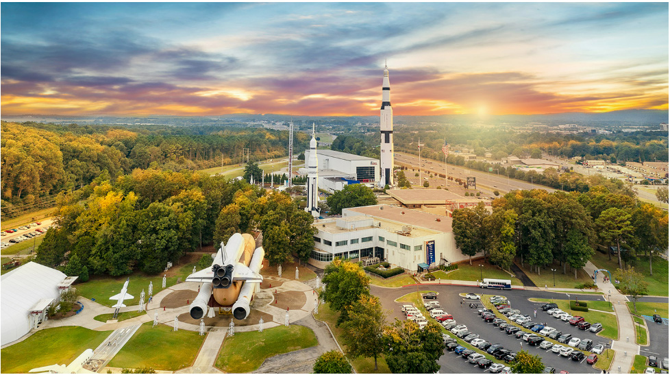
We support the educator, not just the classroom. Professional development and coach support help you teach with confidence even if drones are new to you, and our funding guidance helps districts find grants to launch a program. Our Student Drone Competition Nationals — culminating at Space Camp in Huntsville — gives students a reason to keep flying past the last lesson.
Where to Find Ag Drone-Mapping Jobs
The jobs are real, and they sit in more places than most people expect. Here is where the hiring happens.
Employer types:
- Precision-ag co-ops and agronomy retailers
- Ag-tech firms and drone-service providers
- Surveying, GIS, and remote-sensing firms
- Universities and extension programs
- Forestry and public agencies, including the USDA Forest Service
Common job titles: precision-ag technician, drone mapping technician, remote sensing analyst, GIS specialist, UAS pilot, and field data specialist.
Pay ranges vary by role and experience. Drone surveyors generally earn in the range of $51,000 to $96,000, while UAV and LiDAR specialists can reach $80,000 to $130,000 or more, according to figures from ZipRecruiter, Emlid, and Land Surveyors United. The Bureau of Labor Statistics projects surveying and mapping technician roles to grow about 5% from 2024 to 2034.
Postings show up on Indeed, ZipRecruiter, USAJOBS, and the career pages of co-ops and universities. Point your students there early, and have them watch how job descriptions describe the skills.
Build the Pathway Your Students Are Ready For
Agriculture needs people who can turn imagery into decisions — and there are not enough of them yet. That gap is your students’ opportunity.
Rocket Drones gives you the curriculum, the certification pathway, and the classroom support to launch a drone program without assembling the pieces yourself. You bring the students. We bring the environment that gets them career-ready.
Ready to see what a mapping pathway looks like in your classroom? Contact us to start the conversation.
Frequently Asked Questions
How do you plan a drone mapping flight?
Do you need a license for agricultural drone mapping?
What is the difference between RGB and multispectral mapping?
How do prescription maps work with variable-rate equipment?
What jobs use agricultural drone mapping?
Nationals 2026
is around the corner.
Aerial Perspectives Podcast
Discover the exciting world of drones with Aerial Perspectives! Each episode takes you behind the scenes with drone pilots from diverse industries–cinematography, construction, inspection, agriculture, and more.


