Drones in Agriculture: The Complete Guide
A single farm can stretch across thousands of acres, and a problem in one corner can go unnoticed until it costs a season’s yield. Drones change what a farmer can see and do across all that ground. They fly overhead, gather detailed data, and in some cases apply treatments directly to the crop. This guide walks through the whole picture — from what these aircraft actually do in a field, to the licenses that govern the work, to the careers forming around it. No prior knowledge is required. Start at the beginning and build from there. You will learn the three core jobs drones do on a farm, how mapping and scouting turn fields into decisions, how spray drones apply treatments, what the FAA rules require, where the jobs are, and where the technology is headed.
Drones in Agriculture: An Overview
Drones do three core jobs on a farm: mapping, monitoring and scouting, and spraying. It helps to picture them as three categories of work — sensing, decision support, and treatment. The distinction that surprises most people is how the work actually splits. Remote sensing has historically dominated agricultural drone use — far more flights collect data than apply material. The image of a drone dusting a field is real, but it is the exception. Far more often, a drone flies overhead to collect data that helps a farmer decide where to act.
That single fact shapes how the whole field works, and it structures this guide. Mapping and imaging come first, because they turn a field into usable data. Monitoring and scouting build on that data to catch problems while they are still fixable. Spraying is the specialized application that closes the loop, acting on what the sensing revealed. Sensing leads; treatment follows.
Why Farmers Invest
The reason farmers invest in this technology comes down to money and precision. Drone use in corn, soybean, and wheat could save U.S. farmers an estimated $1.3 billion a year, according to the University of Maryland Extension’s overview of drones in agriculture. Those savings come from doing the right thing in the right place — spotting a problem zone early, applying inputs only where they are needed, and skipping the guesswork that wastes seed, fertilizer, and fuel. A drone gives a farmer a view of every acre instead of a windshield glance from the road, and that changes the quality of every decision that follows.
Adoption is climbing, and the broader precision-agriculture trend supports that direction. The USDA Economic Research Service’s work on precision agriculture in the digital era reports that autosteer guidance was used by 52% of midsize crop farms and 70% of large crop farms in 2023. Drone use is climbing that same curve, moving from early adopters toward standard practice.
What This Looks Like on a Real Farm
Concrete examples show why. A North Carolina farmer used a drone spreader that cost around $35,000 in place of a ground sprayer that runs closer to $250,000, according to Associated Press reporting from December 2024. That is a dramatic difference in the cost of entry for a farm operation. On the sensing side, an Illinois grower scouts for weeds and disease using NDVI imagery — a plant-health measure captured from the air — as reported by the Journal-Courier in April 2026. One farmer spreads material at a fraction of the traditional equipment cost. Another sees crop stress across a whole field without walking every row. Both are solving a specific, expensive problem with a drone.
How This Guide Is Organized
Here is the roadmap for the rest of this guide. Mapping and imaging turn a field into data. Monitoring and scouting use that data to catch problems early. Spraying and treatment apply inputs with precision where they are needed. FAA regulation defines who is allowed to do each job and how. Jobs and workforce show where the careers are. And future trends point to where the field is headed. Sensing is where it all begins, so mapping and imaging come first.
How are drones used in agriculture?
What are the benefits of using drones in agriculture?
Mapping & Imaging
Aerial crop imaging is the foundation of everything else a drone does on a farm. A drone flies a programmed pattern over a field and captures hundreds or thousands of overlapping photos. Software then stitches those photos into large, georeferenced maps and data layers a farmer can actually use. This is where raw flight turns into information, and it is the first step in any serious agricultural drone workflow.
What Drone Imagery Actually Produces
The outputs are more varied than a single aerial photo. Drone imagery gets processed into orthomosaics, digital surface and terrain models, plant-health layers, management zones, variable-rate application prescriptions, stand counts, and drainage models. Each of these answers a different question. An orthomosaic is a single seamless map built from many photos, corrected so distances and areas are accurate. As the University of Maryland Extension’s drone overview explains, orthomosaics stitch aerial photos into large georeferenced maps and also capture NDVI, elevation, and crop-health data. A stand count tells a farmer how many plants actually emerged. A drainage model shows where water will pool. Every layer is a tool for a specific management choice.
NDVI and NDRE: Knowing Which to Fly
Two of the most important plant-health layers — NDVI and NDRE — are related but not interchangeable, and knowing which to fly and when is a real skill. NDVI reads overall crop vigor and is most useful earlier in the season, before the canopy fills in completely; once the canopy closes, the index saturates and loses sensitivity to differences between plants. NDRE uses red-edge wavelengths that penetrate deeper into a dense canopy, staying informative well into mid- and late-season growth stages when NDVI has stopped telling the story. An operator who understands both indices — and can choose the right one for the crop stage and objective — produces data a farmer can actually use.
The Science Behind the Layers
The science behind these layers goes deeper than ordinary color photography. Research from the USDA Agricultural Research Service on small unmanned aircraft for high-throughput phenotyping shows that imaging spectroscopy from drones can estimate plant biomass, nitrogen content, water content, greenness, and the presence of disease. The drone reads light reflected off the crop in bands the human eye cannot see, and those readings correlate with the plant’s condition. This is the difference between looking at a field and measuring it.
What the Sensors Can Do
The sensors that make this possible pack a lot into a small package. A sensor like the DJI Mavic 3M carries a 20-megapixel RGB camera plus a four-band multispectral sensor covering green, red, red-edge, and near-infrared light. It uses RTK positioning for centimeter-level accuracy and can cover up to roughly 200 hectares in a single flight. The specific hardware matters less than the principle: a compact aircraft can now capture research-grade imagery across a large field in one battery cycle. That capability used to require an airplane or a satellite.
Why Repeat Flights Matter
One of the most valuable habits in aerial imaging is repetition. A drone can fly the same field again and again across a season, capturing the same layers each time. That repeat imagery lets a farmer track change — how a crop is developing, where stress is spreading, whether a treatment worked. A single map is a snapshot. A season of maps is a story, and the story is what drives smart management.
The Limit of Imaging
There is an important limit built into all of this. NDVI and similar plant-health layers flag stress patterns; they do not identify the cause. A map can show that plants in the northeast corner are struggling without telling anyone why. Answering that requires a person on the ground looking closely. Imaging tells you where to look. The follow-up work tells you what is wrong.
That handoff is exactly why mapping leads directly into crop monitoring and scouting. The imagery a drone captures becomes the starting point for diagnostic work in the field. A farmer flies the field, reviews the health layers, marks the abnormal zones, and then investigates each one. Mapping builds the picture; scouting fills in the meaning.
What is aerial crop imaging?
What is the difference between NDVI and NDRE?
Crop & Field Monitoring and Scouting
Traditional crop scouting has a coverage problem. A farmer or agronomist checks the field from the road or walks a handful of selected rows, then assumes the rest looks the same. Big problems hide in the acres nobody walked. Drones close that gap by giving a field-wide crop-health review across every acre. The workflow is a clean division of labor: the drone flags the abnormal zones, and the scout diagnoses the cause. This is the practical bridge from the maps in the previous section to action in the field.
What the Drone Finds, What the Scout Confirms
The drone flags where something looks wrong. The scout confirms what is actually happening. That distinction is the heart of drone scouting — and the barrier to entry is lower than most educators assume. Ordinary RGB aerial photography at typical agricultural altitudes can reveal nutrient deficiencies, pest damage, and irrigation problems. A standard camera gives a scout a field-wide view that no windshield check can match. Multispectral and thermal imaging go further, adding layers that detect stress before it becomes visible in color — but they are tools for specific objectives, not the price of entry into drone scouting. A school program does not need a multispectral sensor to teach meaningful monitoring work; a drone narrows a whole field down to a handful of zones worth investigating, and a knowledgeable person on the ground determines the cause. Neither piece works well without the other. The drone makes the scout’s day efficient; the scout makes the drone’s data meaningful.
Reading Multispectral Data
The multispectral data layer is what makes this powerful when it is added. Three measures do most of the work, as documented by Auburn University’s Alabama Cooperative Extension System. NDVI reads overall plant vigor and is most useful earlier in the season — once the canopy closes, the index saturates and stops detecting differences between plants. NDRE uses red-edge wavelengths that penetrate a dense canopy, staying informative deeper into mid- and late-season growth stages when NDVI has lost its sensitivity. NDMI tracks water status in the crop. Each index reads the crop’s reflected light differently, and together they paint a picture of how a field is doing that no roadside check could match. A scout who understands these three layers can prioritize a whole day’s work before ever setting foot in the field.
How It Compares to Older Methods
The reliability of this data holds up against older methods. Research from Virginia Tech Extension on unmanned aircraft in crop production found that drone-derived NDVI is more reliable than handheld SPAD meters for detecting nutrient response and predicting winter-wheat yield. That is a meaningful finding. A SPAD meter measures one leaf at a time; a drone measures the whole field at once and does it more dependably for these purposes. For a farmer trying to decide where to apply nitrogen or how a field will yield, that reliability translates directly into better decisions.
Weed and Disease Detection
Weed and disease detection are where scouting technology is advancing fastest. Combining drone imagery with multispectral data and machine learning allows rapid weed monitoring across large fields — spotting the patches of green that do not belong, as the University of Maryland Extension overview describes. Disease detection is following the same path, though it is still emerging. It requires crop-specific models and field validation before it can be trusted broadly. A drone flagging a pattern is a strong lead, and the scout on the ground confirms the cause.
What Drones Cannot See
Soil presents a clear limit. Drones do not directly measure root-zone moisture or nutrients. What a drone measures is the crop’s response — how the plants above the soil look and reflect light. From that response, a farmer can infer what might be happening below. To actually explain what is going on beneath the canopy, soil probes and ground sampling are still required. A drone reads the symptom from above; a soil probe reads the cause from below. Both belong in a complete scouting toolkit.
Livestock and Irrigation Monitoring
Beyond crops, drones handle two secondary jobs that round out field monitoring. On livestock operations, thermal cameras let a rancher check a herd’s condition and location, and drones can help with mustering — moving animals across pasture. On the water side, irrigation monitoring is where drone data does specific, measurable work. Thermal imaging reveals canopy temperature differences that indicate water stress across a field before visible wilting begins. Drones also inspect center-pivot infrastructure — checking for clogged nozzles, leaks, and uneven coverage that a ground check might miss — and capture the elevation and drainage patterns that explain where water pools or fails to reach. This is data collection and analysis, not water delivery. Carrying the mass of water needed to irrigate a field is not practical for any current drone platform; the value is identifying where the irrigation system is failing and why.
The through-line here is that monitoring turns mapping data into managed action. A drone flies, the health layers reveal the trouble spots, and a knowledgeable person investigates each one. That investigation often ends in a decision to treat part of the field — and treatment is where the next set of drone skills comes in.
What is drone crop scouting?
Do you need a multispectral camera for crop scouting?
Can drones monitor irrigation?
Spraying & Treatment
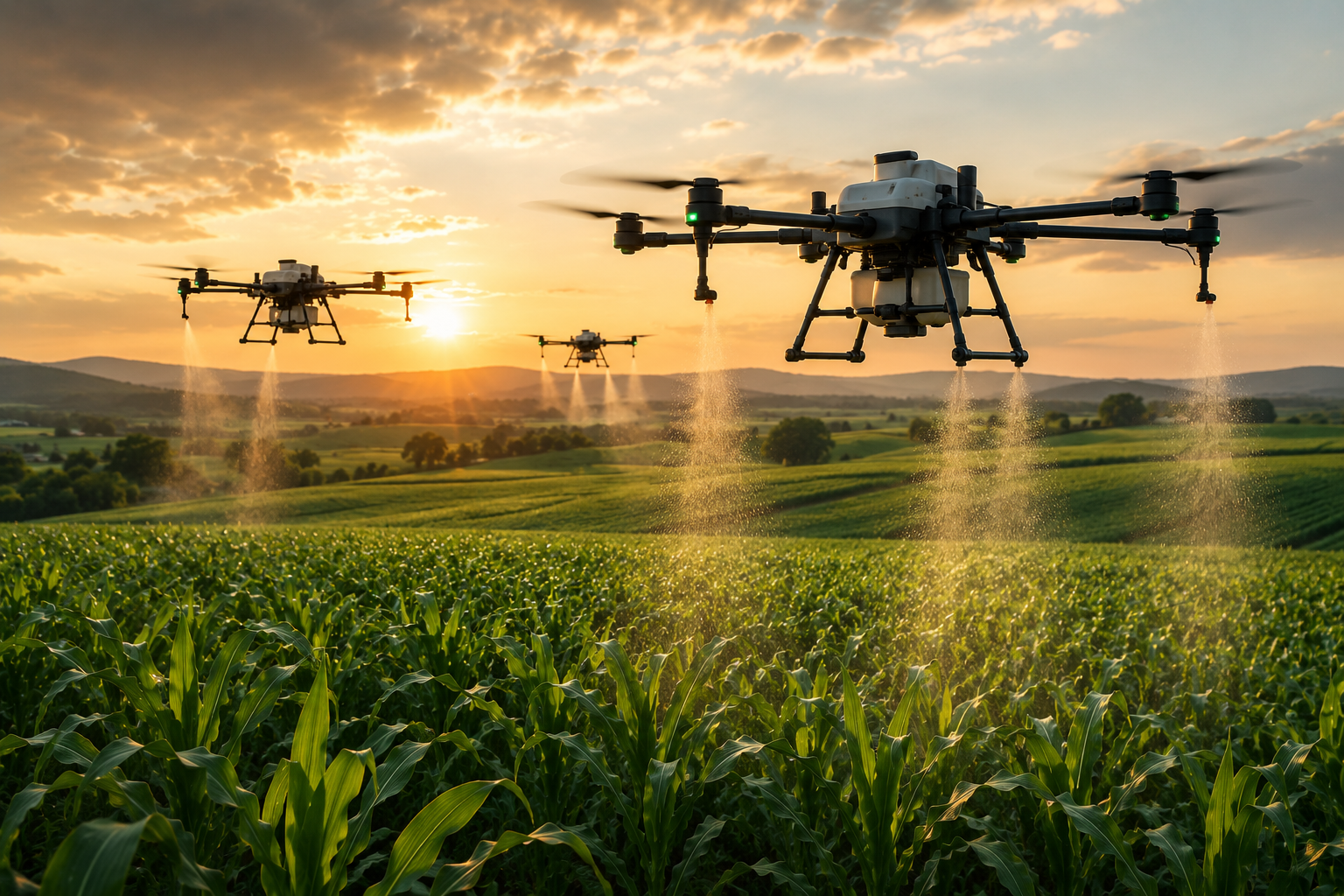
Spray drones are the application end of the workflow. Where mapping and scouting gather information, spray drones act on it. They apply liquid pesticides, herbicides, fungicides, and foliar fertilizer, and they also handle dry work — spreading seed and granular fertilizer. Once a scout has identified where treatment is needed, a spray drone can deliver it to those specific areas.
Where Drones Beat Ground Equipment
These aircraft earn their keep in the places ground equipment struggles. A tractor-pulled sprayer is a poor fit for hilly terrain, wet fields, oddly shaped fields, and areas cluttered with poles or obstacles. It also crushes crops under its wheels, causing damage in tall or delicate plantings. A drone flies over all of it. That is why the technology often shows up first on the acres that were hardest to service the old way — the corners, the slopes, and the soggy ground where a heavy rig would sink or do damage.
How Spray Drones Work
The way spray drones work sets them apart from ground equipment. They fly programmed swaths back and forth across a field using a tank, pump, and nozzle system guided by RTK navigation for accurate, repeatable passes. The volumes involved reveal how different this is. According to Ohio State University CFAES research on drones for spraying pesticides, spray-drone application rates typically run 1.5 to 2 gallons per acre — far below the 15 to 30 gallons per acre of conventional ground rigs. That low volume means spray drones require ultra-low-volume formulations, chemistry mixed to work effectively in a small amount of liquid. This shapes what products can be used and how they must be prepared.
The Variables That Decide a Good Application
Several operational variables determine whether a mission produces a good application or a wasted one. Nozzle type versus rotary atomizer is the first decision: flat-fan nozzles and rotary atomizers produce different droplet spectrums, and droplet size drives both coverage and drift risk. Swath width must be calibrated to the specific aircraft, not assumed from a generic number — an uncalibrated swath leaves gaps or overlaps that neither the farmer nor the label intended. Flight speed and altitude directly alter droplet distribution and drift; flying too fast, too high, or into the wrong wind conditions can push material off target. Rotor downwash is both an asset and a variable: the airflow from the rotors pushes droplets into the canopy, improving penetration, but that effect changes with crop height, canopy density, and flight altitude. Product labels carry the force of law, and low-volume application does not exempt an operator from minimum per-acre rates, adjuvant requirements, or buffer restrictions — a formulation mixed for ultra-low volume must still meet every label requirement. Finally, the real throughput ceiling on most operations is battery swaps and tender refills, not the aircraft’s speed or tank capacity. An operator who hasn’t planned the ground logistics — battery rotation, water supply, mixing station — will lose more time on the ground than in the air.
Equipment and Capacity
The equipment scales to the job. The DJI Agras line runs from the T25, which carries about 20 kilograms of spray or 25 kilograms of spread material, up through the T50 at roughly 40 kilograms of spray with a 16-liter-per-minute flow rate, to the T100 with a 100-liter tank and a 40-liter-per-minute flow. The pattern is clear: bigger aircraft carry more and cover ground faster. Spray capacity and flow rate are the numbers that determine how many acres an operator can treat in a day.
Licensing and Legal Requirements
The legal picture is where spraying diverges sharply from sensing. Dispensing chemicals, fertilizer, or seed from an aircraft may trigger FAA Part 137, which requires an Agricultural Aircraft Operator Certificate — but applicability depends on what is being dispensed and the nature of the operation. Operators must determine whether their specific work falls within the rule rather than assuming it always applies. As of May 2026, FAA Notice 8900.773 (issued 15 May 2026) cancels and replaces Notice 8900.741, formalizing a revised, streamlined Part 137 UAS certification process. The FAA’s stated rationale is that Part 137 UAS agricultural operations present a lower risk than other certificated operations. On top of any federal Part 137 requirement, a state pesticide-applicator license is also required, and it varies by state. Pesticide labels carry the force of law — applying a product against its label instructions is a violation. Drones required to be registered generally must also comply with Remote ID, though FAA-recognized identification areas and specific authorization paths exist. The full federal requirements are laid out in the FAA’s guidance on dispensing chemicals and agricultural products under Part 137. This regulatory layer is significant enough that the FAA and regulation section of this guide covers it in full.
Drift and Safety
Drift is the safety concern that governs every spray decision. Whether droplets stay on target depends on droplet size, wind, flight height, and the product label — and third-party research on drone spray behavior is still developing. That is why calibration and label compliance are not paperwork; they are the difference between a legal application and a damaging one. A skilled operator manages those variables on every pass.
The Scale of Drone Spraying Today
The scale of drone spraying is growing quickly. The American Spray Drone Coalition’s industry survey estimates treated acreage rose from 3.7 million U.S. acres in 2023 to 10.3 million in 2024 and 16.4 million in 2025 — a 58.7% increase year over year. Precision spraying also shows promise for reducing chemical use. A 2024 sugarcane study found spot spraying cut herbicide use by an average of 35%, and by as much as 65% in some cases. That reduction comes from treating less area — applying product only where weeds actually are, rather than blanketing an entire field. The per-acre dose does not change; the labels still govern how much product goes down wherever the drone does spray. Whole-field broadcast spraying delivers no such reduction, because the treated area stays the same. The precision of the workflow drives the savings, when the application is calibrated and managed correctly.
Spraying is the most regulated corner of agricultural drone work, and it depends on getting the rules right. That makes regulation the natural next stop — the federal framework that governs who may fly each kind of mission.
How do drones spray crops?
Do you need a license to spray crops with a drone?
FAA & Regulation: Part 107 vs Part 137
Regulatory guidance in this section reflects FAA requirements as of May 2026. These rules change regularly — confirm current requirements directly with the FAA before beginning any commercial operation.
Regulation is where agricultural drone work gets specific. The federal rules split into two parts that govern two different kinds of work. Part 107 covers the non-dispensing work described throughout this guide — scouting, mapping, and monitoring. Part 137 may apply to certain agricultural dispensing operations, depending on what is being dispensed and the nature of the operation; operators need to determine whether their specific work falls within the rule rather than assuming it always does. These are different rules for different operations, filed on different forms through different channels. Part 107 remote pilot applications use Form 8710-13; Part 137 Agricultural Aircraft Operator applications use Form 8710-3. Do not confuse the two.
Part 107: The Base Certification
Part 107 is the base certification for all the non-dispensing work covered earlier in this guide — scouting, mapping, and monitoring. It requires a Remote Pilot Certificate and covers small unmanned aircraft weighing under 55 pounds. A prospective pilot applies using Form 8710-13 through the FAA’s IACRA system after passing a knowledge test. Aircraft registration costs $5 and lasts three years, and pilots must maintain knowledge recency every 24 months. The FAA’s guidance for certificated remote pilots and commercial operators lays out the requirements. For the imaging and scouting work that makes up the overwhelming majority of agricultural drone use today, Part 107 is the credential that opens the door — but it is not the spray license, and it does not replace Part 137 where that rule applies.
Part 137: When Dispensing Is Involved
Part 137 is a separate certificate for a separate activity. Whether it applies depends on what is being dispensed and the nature of the operation — applicability is not automatic, and operators must determine whether their specific work falls within the rule. When it does apply, the work requires an Agricultural Aircraft Operator Certificate, applied for using Form 8710-3 and filed through FAA Flight Standards. As of May 2026, FAA Notice 8900.773 (issued 15 May 2026) cancels and replaces Notice 8900.741, formalizing a revised, streamlined Part 137 UAS certification process; the FAA’s stated rationale is that Part 137 UAS agricultural operations present a lower risk than other certificated operations. The full process is detailed in the FAA’s Part 137 agricultural aircraft operations guidance. This certificate applies to the dispensing operation specifically and sits alongside the Part 107 base, not in place of it.
Weight and the 55-Pound Threshold
Weight adds another layer to the rules, and it matters most for spraying. The 55-pound threshold that defines a small unmanned aircraft is measured by takeoff weight including payload, not the empty weight of the aircraft. That distinction is significant for spray drones, because a large tank full of liquid can push total weight well past 55 pounds. When loaded weight reaches or exceeds 55 pounds, the operation moves under Part 91 and requires a Section 44807 exemption plus a third-class medical certificate. Many of the larger spray platforms fall into exactly this category once loaded, so an operator planning to run bigger equipment needs to understand this pathway before buying an aircraft.
Remote ID
Remote ID applies to drones required to be registered, with some nuance. Registered aircraft generally must comply with Remote ID requirements during flight, but FAA-recognized identification areas and specific authorization paths exist. Operators should confirm current Remote ID obligations for their aircraft and operation before flying commercially.
State Licensing Sits on Top
State licensing sits on top of all the federal requirements, and it varies. A state pesticide-applicator license is required for spraying work in addition to the federal certificate, and the specific rules differ from state to state. Minnesota, for example, requires both FAA Part 107 and a state license. California requires a Department of Pesticide Regulation Pest Control Aircraft Pilot Certificate. Restricted-use pesticides require a certified applicator on top of everything else. A license in one state does not automatically authorize work in another, so anyone building a spraying operation has to check the specific requirements in every state where they intend to fly.
The regulatory picture clarifies how the work is organized. Part 107 is the foundation. It covers all the sensing and scouting work and is the credential most agricultural drone operators rely on. Part 137 and state applicator licensing are advanced steps tied to the specialized spraying work, added on top of the Part 107 base. That progression mirrors the industry itself, where most operators start with sensing work and specialize into dispensing over time. With the rules in place, the picture turns to the kinds of careers this work supports.
What is the difference between Part 107 and Part 137?
How do you get a Part 137 certificate?
Jobs & Workforce
The career picture for agricultural drone operators is real, and it deserves an honest description. There is no standardized federal occupation for an agricultural drone pilot — no BLS wage category, no tidy median to cite. The people getting hired don’t just hold a Part 107 certificate. They combine it with field operations experience, imaging and sensor knowledge, mapping and GIS skills, agronomy context, and the ability to process data and hand a farmer something actionable. Piloting alone is the commoditized part. It gets a résumé looked at. What wins the role — and protects earnings as more operators enter the market — is the skill stack built around the flight.
What the Market Data Actually Shows
The market tells the honest story behind that framing. The FAA reported 1,710 unmanned Part 137 operating certificates as of June 2025 — that is the FAA’s own count of authorized dispensing operators. The American Spray Drone Coalition’s industry survey estimates, built on that operator base, tell a different story underneath: treated acreage reached an estimated 16.4 million acres in 2025, a 58.7% year-over-year increase, driven by a 58.3% rise in approved operators. The FAA measured the operator count. The ASDC estimates the acreage, growth rates, and per-operator economics — the FAA did not measure those figures. On that basis, the ASDC estimates average acres per operator held at roughly 9,584, while average price per acre fell from around $21 to $13. More operators entered the market; each one is covering about the same ground and charging less for it. That is the honest picture of a maturing service market — growing in total volume, compressing on price, and rewarding the operators who bring more than a controller to the job.
The broader remote-pilot pool is growing steadily. The FAA reports 493,396 remote-pilot certifications in 2025 and forecasts roughly 628,600 by 2030, a 28% increase.
Building a Custom Service Business
Demand is emerging rather than saturated. For many, the clearest path to income is entrepreneurship. A seasonal custom-service business is the most common model — an independent operator offering services to farms across a region. That service menu typically includes mapping, stand counts, scouting, spraying and spreading, and storm documentation. The economics require realistic planning. Equipment commonly runs $30,000 to $50,000, and on top of that an operator carries the cost of licensing, insurance, and the seasonality of farm work, which concentrates income into certain months of the year. The USDA Economic Research Service report on precision agriculture in the digital era provides context on how these technologies fit into farm operations.
Who Hires for These Skills
The range of employers goes well beyond individual farms — and the job titles reflect that. Current 2026 postings rarely say “drone pilot.” A Rutgers agricultural research position pairs Part 107 with data processing and research support. A SurePoint Ag Systems Drone Imaging Agronomy Internship covers flight planning, imagery collection, and precision-ag analysis. A UC Agriculture and Natural Resources Drone and GIS Community Education Specialist combines drone operations, GIS, agriculture mapping, and workforce development. The titles that show up are agronomy technician, GIS specialist, precision-ag technician, research support, and community education specialist. Skills in agricultural drone work are valued by:
- Farms running in-house programs — hiring precision-ag technicians who map fields, analyze crop-health data, and manage variable-rate decisions.
- Custom applicators who spray and spread for hire — operators who pair Part 107 with field operations knowledge, not just a controller.
- Co-ops and ag retailers that offer drone services — staff roles combining agronomy context with mapping and data workflows.
- Crop consultants who add aerial data to their advice — positions where GIS skills and NDVI interpretation sit alongside traditional scouting credentials.
- Agtech firms building the software and hardware behind these tools — research support and field-data specialist roles that require both flight skill and data literacy.
- Extension programs researching and teaching the technology — community education specialist positions, like the UC ANR model, that blend drone operations, GIS, and workforce development into a single role.
That breadth matters. A person who builds these skills is not betting on a single job title. They are gaining a capability that a whole ecosystem of agricultural employers needs, which makes the training resilient across changing market conditions. The strongest position an operator can hold is a combination: the Part 107 credential, real piloting skill, an understanding of mapping and scouting data workflows, and awareness of the business realities of the field. That mix is what turns a certificate into a career.
Is there demand for agricultural drone pilots?
Can you make money with an agricultural drone?
Future Trends & Outlook
The direction of agricultural drones is growth, but the specifics deserve a clear-eyed read. Market forecasts disagree sharply on the numbers. One firm projects the market rising from $2.63 billion in 2025 to $10.76 billion by 2030. Others land elsewhere — $13.2 billion by 2033, $23.78 billion by 2032, $3.9 billion by 2031 — with annual growth rates ranging from the mid-teens into the low thirties percent. Estimates for the current market span roughly $1.5 billion to $6.1 billion for 2025 alone. The firms disagree on the size, but they agree on the direction: fast growth.
A steadier anchor comes from the government rather than market-research firms. The FAA Aerospace Forecast puts the active Part 107 fleet at roughly 424,500 aircraft at the end of 2025, growing to about 541,000 by 2030 — a 5% compound annual growth rate. That is a government-sourced figure describing the broader commercial remote-pilot fleet, not agriculture alone, but it gives a concrete reference point grounded in FAA data rather than vendor projections.
Sorting the technology trends by readiness tells a more honest story than listing them as a single wave.
Deployed today: RTK mapping, multispectral analysis, and spray systems are in commercial use on working farms right now. Larger aircraft are flying with less direct human input at every moment — the Guardian Agriculture SC1 covers roughly 60 acres per hour, Rotor Technologies builds larger autonomous Sprayhawks, and platforms like the DJI Agras T100 integrate LiDAR, vision, and radar for obstacle awareness. The pattern across all of them is aircraft that carry more, fly longer, and require the operator to manage a mission rather than steer every second. That shift in the operator’s role — toward planning, oversight, and data management — is already happening.
Early commercial: Large autonomous application platforms are entering the market but are not yet standard. A few operations are running them; most farms are not. This is the tier that will define the next several years.
Pilot and research: AI-assisted imagery interpretation is where active investment is concentrated. USDA ARS launched a July 2026–October 2028 project using deep learning on drone imagery to map rangeland plant communities and invasive species. USDA’s broader AI strategy specifically names computer vision over satellite, drone, and ground imagery as a priority. The science is advancing; field-ready deployment at scale is still ahead.
Speculative: Coordinated drone swarms — many aircraft flying a single mission together — are an active research area, not a common sight on American farms.
What the Readiness Ladder Means for Workers
This readiness ladder matters for the workforce picture as much as for the hardware. Manual piloting skill remains the foundation because an operator who understands how to fly by hand understands what automation is doing and can step in when it matters. And what the most capable operators bring beyond the stick is expanding. Precision application is entering mainstream Extension training — Iowa State’s 2026 agricultural drone workshops report rising interest among producers, agronomists, and applicators — and hiring is converging on the same combination: flight, GIS, and data interpretation together. That is not a future credential stack. It is what employers are asking for now.
The BVLOS Question
The biggest regulatory shift on the horizon is flight beyond visual line of sight, known as BVLOS. Today most drone work requires the pilot to keep the aircraft in sight, which limits how much ground one operator can cover. The FAA’s proposed “Normalizing UAS BVLOS” rule specifically names agriculture as a use case. This is a proposed rule, not a finalized one. If it is adopted, routine beyond-visual-line-of-sight flight would let a single pilot cover more acres, fly longer routes, and coordinate multiple aircraft — a shift that would reshape the economics of the entire field.
Sustainability, Concretely
Sustainability is the last trend, and it works best described concretely. The environmental case for agricultural drones is not a vague promise of being “green.” It is specific and measurable: precision. Spot spraying cut herbicide use by 35% to 65% in field studies by treating only the areas that needed treatment. That reduction comes from treating less area — the per-acre dose where the drone does spray is still governed by the label. The benefit is real, and it is earned through skilled, calibrated operation.
The overall picture is an industry expanding steadily, becoming more autonomous, waiting on a major regulatory shift, and delivering measurable precision gains. Everything in this guide points to the same underlying truth — this work rewards people who understand aviation safety, data, field conditions, and regulation as a connected whole. That is exactly the kind of skill a classroom can build.
Rocket Drones & CTE
Agriculture is where the career case for a drone program is easiest to make — because students can see the entire chain in one place. The logic of this guide is the logic of the job. Mapping turns fields into data. Scouting turns that data into decisions. Treatment closes the loop. Every step follows a clear sequence, and every step connects to a real employer. A student who works through that chain learns to fly an aircraft safely, collect field data, interpret crop conditions, understand how treatment decisions are made, follow FAA rules, and connect all of it to the industries that pay for those skills. That is not a collection of isolated lessons. That is a career pathway with every link visible from the classroom.
The Pathway Already Exists
Agricultural drone work leads to roles in crop scouting, precision-ag data analysis, GIS and mapping, field operations, and eventually specialized spraying and treatment work. Florida’s Department of Education already treats this as a CTE course — course 8005200, “Agriculture Use of UAS Technology,” is embedded in the Agriculture, Food & Natural Resources curriculum frameworks. Purdue Extension’s UAV training combines Part 107 preparation with hands-on manual and planned flights for farmers, educators, and youth. Iowa State’s Digital Ag Innovation Lab runs agricultural drone workshops that teach both regulatory knowledge and safe operation. UC ANR’s Drone and GIS Community Education Specialist role ties that same skill set — drone operations, GIS, agriculture mapping — directly to workforce development. The pathway is real, the employers are hiring, and the job titles are already posted.
What Students Actually Need
What students need is a program that connects the flight to the data and the data to the decision. That is what a well-built CTE drone program does — and it is what Rocket Drones is built to support. Contact us to learn how to bring a drone curriculum into your classroom.